|
Hawai`i
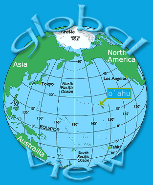
Hawai`i is an isolated archipelago in the middle of the Pacific
Ocean, approximately 2,550 miles southwest of Los Angeles
and about 3,900 miles southeast of Tokyo.
First settled
by Polynesians between A.D. 300 and 600, Hawaii was visited
by British captain James Cook in 1778. He named them the Sandwich
Islands.
Politically
Hawaii is part of North America as a U.S. State, but geographically,
because of its (isolated location,) it is not considered part
of any continent.
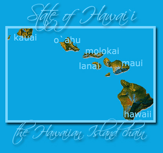
It's comprised
of 8 major islands (Oahu, Hawaii, Maui, Kauai, Molokai, Lanai,
Kahoolawe, and Niihau) and a series of smaller ones. Hawaii
is the world's longest island chain.
On December
7, 1941, the Japanese attacked Pearl Harbor on the island
of O`ahu, and the United States entered World War II.
Today the
islands are one of the premier travel destinations in the
world, and to quote Mark Twain, "The loveliest fleet
of islands that lies anchored in any ocean..."
These
lush, green islands are the visible tops of a chain of submerged
volcanic mountains that stretch 3,100 miles from Hawaii, all
the way to the Aleutian Trench in the north Pacific Ocean.
Most
are now inactive stumps of volcanic rock, encircled by coral
reefs.
The youngest
volcano (Kilauea), in Volcanoes National Park on the Big Island,
still erupts occasionally, spewing lava and creating new land.
Maui's Haleakala is still considered active, but is not currently
erupting.
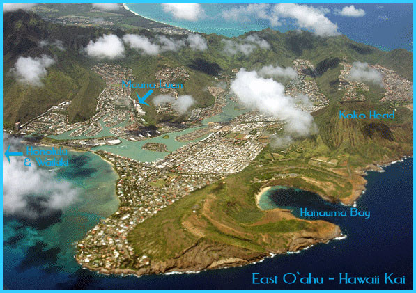
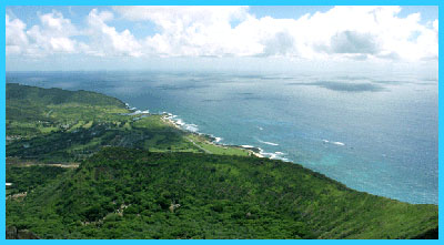
Numerous sea cliffs fringe the outer edges of the islands,
and rugged valleys, crater remnants, canyons and waterfalls
are commonplace.
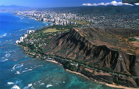
O`ahu's Diamond
Head, the most famous landmark in the island chain is a large
volcanic tuff cone formed by a series of explosive eruptions
an estimated 100,000 years ago. Ironically, in this tropical
paradise, the tops of Mauna Loa and Muana Kea on the Big Island
are snow-capped.
Climate
The Hawaiian Island's weather is very consistent, with only
moderate changes in temperature throughout the year.
There are
only 2 seasons: the summer months (called Kau in Hawaiian)
that extend from May to October and the winter months (Ho'oilo)
that run from November to April.
The average
day-time summer temperature at sea level is 85 degrees F.
(29.4 C) while the average day-time winter temperature is
78 degrees (25.6 C).
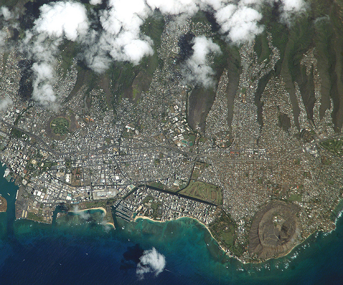
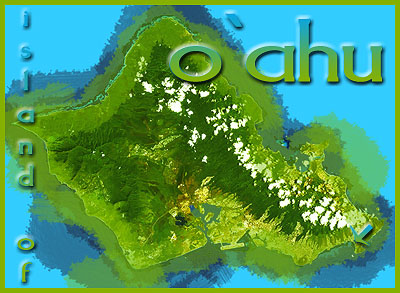
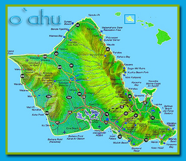
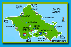
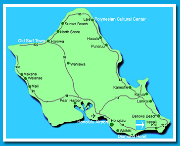
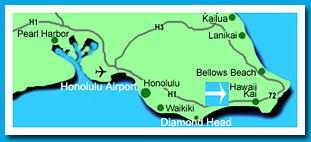
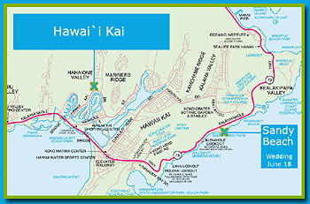
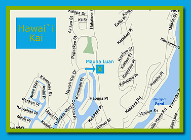
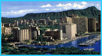
O`ahu
The main island - the one with Honolulu, Waikiki, Don Ho,
Pearl Harbor, and the fictitious "Hawaii Five O".
Known to the ancient Hawaiians as "The Gathering Place",
O`ahu is truly one of the most beautiful Islands in the world.
Honolulu is
the State Capitol as well as the county seat. Total area is
594 sq. miles - 44 miles long and 30 miles wide and 112 miles
of coastline. O`ahu is also the most populated Hawaiian Island
with over 950,000 residents. The highest point is Kaala Peak
with an elevation of 4,003 ft above sea-level.
|
|
|
Hawai`i
Facts
Statehood
- Aug. 21, 1959 (50th state)
Capital
- Honolulu
Currency
- U.S. Dollar
Language
- English (official), Hawaiian (official) - The melodious
Hawaiian language is a polynesian dialect
Largest
Cities (by population) Honolulu, Hilo
Lat/Long
21º 32' N, 157º 80' W
Origin
of Name - from the ancient Polynesian homeland called
Hawaiki
Population
- 1,244,898 (42nd)
State...
Bird - Hawaiian Goose
Flower - Yellow Hibiscus
Fish - Humuhumu-Nukunuku-A-Pua'a
Gem - Black Coral
Marine Mammal - Humpback Whale
Motto - "The Life Of The Land Is Perpetuated In
Righteousness"
Nicknames - "The Aloha State"
Song - "Hawaii Ponoi"
Tree - Kukui or Candlenut
Largest County (by population) Honolulu, 876,156
Highest Point Mauna Kea, 13,796 ft.
Lowest Point Sea Level, Pacific Ocean
Geographic Center 1Near the island of Maui
Timeline of History
(A.D.
300) Polynesians, thought to be from the Marquesas Islands,
migrate to Hawaii
(1778)
British captain James Cook arrives at Kauai
(1789)
Captain Cook killed on the Big Island
(1795)
King Kamehameha I conquers O`ahu, as he attempts to
unify the islands
(1820)
Christian missionaries arrive
(1835)
First sugarcane plantation established
(1885)
Pineapples are first planted
(1893)
Queen Liliuokalani, the last Hawaiian monarch, is overthrown
(1900)
Hawaii becomes U.S. Territory
(1903)
First Hawaiian pineapple is packed and shipped. That
industry, like tourism, dramatically changes the economy
of the Islands.
(1941)
Japanese attack Pearl Harbor
(1950)
The eruption of Mauna Loa (on the Big Island) is considered
huge
(1959)
Hawaii becomes the 50th state
(1982)
Hurricane Iwa destroys parts of Kauai and O`ahu
(1990)
Kilauea erupts, destroying Kalapana
Famous Natives
Hiram Bingham -
missionary
Charles Bishop - business
leader
Barry Bonds - baseball
player
Steve Case - founder
america online (aol)
Don Ho - entertainer
Daniel Inouye- U.S. senator
Duke Paoa Kahanamoku
- olympic swimmer
Israel Kamakawiwo 'ole-
singer
Kamehameha - first king
of hawaii
Bette Midler - entertainer
Liliuokalani - queen
of hawaii
Keanu Reeves - actor
James Shigeta - actor
|
|